

Dolly Became the Fourth Named Storm of 2026, Then Faded Fast
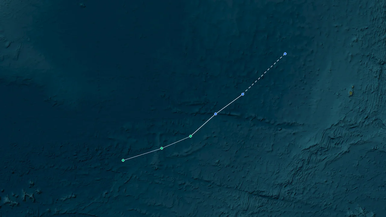
Tropical Storm Dolly formed over the central tropical Atlantic on Aug. 27, 2026, not in the Western Pacific. It reached maximum sustained winds of 40 mph (about 65 km/h) while moving rapidly west toward the Leeward Islands. By the morning of Aug. 28, the circulation had lost its closed structure and Dolly had become an open tropical wave. The storm never reached East Asia, and its short life produced no direct impacts in China, Japan, the Philippines, or Vietnam.
Dolly's 2026 record is a compact example of how quickly a tropical cyclone can move from formation to dissipation when its environment stops supporting a closed circulation. The storm became the fourth named system of the 2026 Atlantic hurricane season after developing from Invest AL96, organized enough to meet tropical-storm criteria, and then encountered increasing structural problems as it moved west.
Its brief existence also created an unusual risk of geographic confusion. Dolly was active at the same time that several Western Pacific and South China Sea systems were affecting East Asia, but the storms belonged to separate basins and followed entirely different tracks. Flooding in southern China, strong winds and travel disruption in Japan, and other late-August hazards across the western Pacific were associated with regional tropical cyclones rather than Atlantic Dolly.
The distinction between those systems is central to any accurate retrospective. Dolly's official history begins and ends in the Atlantic basin, with its tropical-storm phase lasting less than two days and its final tropical-cyclone position remaining hundreds of miles east of the Lesser Antilles.
Atlantic Formation, Not Pacific: Where Dolly Actually Developed
Dolly was designated the fourth named storm of the 2026 Atlantic hurricane season on Aug. 27 after a disturbance monitored as Invest AL96 developed a sufficiently organized low-level circulation and deep convection.
At 1500 UTC on Aug. 27, the center of Tropical Storm Dolly was analyzed near 13.6°N, 38.7°W. Maximum sustained winds were 40 mph (about 65 km/h), with higher gusts, and the minimum central pressure was 1007 mb. The system was moving west at about 24 mph (39 km/h).
The location placed Dolly over the central tropical Atlantic, well east of the Leeward Islands. There was no connection to the Western Pacific, South China Sea, Philippine Sea, East China Sea, or waters surrounding Japan.
The storm's origin was a broad area of disturbed weather that gradually consolidated into a tropical low. Before Dolly received its name, meteorologists had been monitoring Invest AL96 for signs that the circulation would become sufficiently organized to meet tropical-cyclone criteria. Satellite imagery showed a more clearly defined center, while scatterometer observations provided evidence of tropical-storm-force winds.
The first advisory described organized deep convection near the circulation, although the storm was already showing signs of environmental stress. Some of the thunderstorm activity had been displaced from the center by northwesterly vertical wind shear. That structure left Dolly with less symmetrical convection than a strengthening tropical cyclone normally develops.
The initial track was dominated by a strong subtropical ridge over the central Atlantic. That ridge pushed Dolly toward the west and kept its forward motion unusually brisk. Instead of lingering over a small area of ocean, the storm covered a large distance in a short period.
At 2100 UTC on Aug. 27, Dolly was near 13.7°N, 40.7°W. Its maximum sustained winds remained 40 mph (about 65 km/h), and its central pressure was still 1007 mb. The center had already moved roughly two degrees of longitude west from its first official advisory position.
The next several hours continued the same pattern. Dolly remained a tropical storm, but the circulation did not develop the compact, vertically aligned core that would have supported sustained strengthening. The storm's speed also meant that its structure was constantly adjusting as it moved through different parts of the surrounding atmosphere.
By 0300 UTC on Aug. 28, Dolly was near 13.8°N, 42.3°W. Maximum sustained winds remained about 40 mph, while the storm continued west at roughly 23 mph (37 km/h). At 0900 UTC, the center had reached approximately 14.5°N, 44.8°W and was still moving west at around 24 mph.
That track illustrates the defining feature of Dolly's short life: rapid movement rather than rapid strengthening.
The storm was capable of maintaining tropical-storm intensity for a time, but the environment did not allow it to build a durable inner core. Northwesterly shear pushed convection away from the center, while dry air began to enter parts of the circulation. The resulting structure was vulnerable to further disruption.
Dolly therefore never became a hurricane. Its strongest analyzed winds remained around 40 mph (about 65 km/h), below the 74 mph threshold required for hurricane classification in the Atlantic.
The central pressure also stayed relatively high for a tropical cyclone. Dolly formed with a pressure of 1007 mb, and that value remained around the same level through much of its brief tropical-storm phase. There was no dramatic pressure fall associated with a major burst of intensification.
The storm's early forecast track pointed toward the general vicinity of the Leeward Islands, but Dolly's later structural decline changed the nature of the threat. As the closed circulation weakened, the system increasingly resembled a disorganized tropical wave rather than a compact tropical storm.
That evolution is important for understanding why a named storm can disappear from the operational advisory cycle even while its remnants continue to move across the tropics. Tropical-cyclone status depends on the organization of the circulation, not simply on whether strong winds or thunderstorms remain somewhere within the broader disturbance.
Dolly had the wind speed required for tropical-storm classification when it formed, but its organization deteriorated before it could develop into a stronger or longer-lived cyclone.
Rapid Organization and Quick Collapse: Dolly's 48-Hour Life
Dolly's entire tropical-storm history unfolded within roughly a day.
The storm was officially classified at 1500 UTC on Aug. 27. By the morning of Aug. 28, forecasters were already seeing clear signs that the circulation was losing its closed structure. The change was not caused by landfall or a sudden interaction with a major weather system. Instead, Dolly weakened as a combination of vertical wind shear, dry-air intrusion, fast forward motion, and poor convective organization worked against the storm.
At formation, the strongest winds were concentrated in the northeastern part of the circulation. That asymmetry reflected the storm's uneven structure. Deep thunderstorms were more prominent away from the low-level center, leaving the circulation exposed to environmental influences.
A healthy tropical cyclone normally relies on sustained deep convection near its center. Thunderstorms release latent heat, helping maintain the warm-core structure that supports lower central pressure and stronger winds. When convection becomes displaced or collapses, the low-level circulation can weaken rapidly.
Dolly showed this problem almost immediately.
Its westward motion was around 24 mph at formation, then remained close to that level through the following day. Such a fast-moving storm can still intensify under favorable conditions, but Dolly did not have that combination of favorable ingredients. Instead, its circulation moved into an environment where increasing shear tilted the storm's structure and separated the low-level center from its strongest thunderstorms.
Dry air also became more influential. Tropical cyclones generally require a moist surrounding environment to maintain deep convection. When dry air enters the circulation, thunderstorms can weaken, especially when the system is already dealing with wind shear.
Dolly never underwent explosive intensification. Its maximum sustained winds stayed near 40 mph throughout its brief tropical-storm phase, and the pressure remained close to 1007 mb.
The distinction between wind speed and storm organization is important here. Dolly retained tropical-storm-force winds for a time even as its center became less clearly defined. That does not mean the circulation was healthy. It means the remaining stronger winds were still sufficient for the system's operational classification before the closed center disappeared.
At 0300 UTC on Aug. 28, Dolly was near 13.8°N, 42.3°W. At that time, maximum sustained winds were 40 mph and the central pressure was 1007 mb. The storm was moving west at approximately 23 mph.
Six hours later, the center was near 14.5°N, 44.8°W. The storm was still analyzed with maximum sustained winds of about 40 mph, but its organization was becoming increasingly poor.
The storm's wind field was also highly asymmetric. Tropical-storm-force winds were concentrated primarily north and northeast of the circulation, while little or no tropical-storm-force wind extended into the southern side. This pattern is consistent with a system being disrupted by vertical wind shear.
Dolly's sea conditions reflected its status as a small, short-lived tropical storm. Seas reached about 12 feet early on Aug. 28 and later rose to around 15 feet in the open Atlantic. These were marine hazards associated with the storm's circulation, not a coastal surge event.
Because Dolly remained far from land during its strongest phase, there was no major land-based wind damage associated with its peak intensity. The primary operational concern was the storm's eventual approach toward the Lesser Antilles and the possibility of rain and gusty winds from its remnants.
The storm's rapid movement also meant that warnings and forecasts had to account for a system crossing the Atlantic at a substantial forward speed. A storm moving around 24 mph can travel nearly 600 miles in a single day if that speed is maintained. Dolly covered a large portion of the distance between its formation point and the Lesser Antilles without undergoing a corresponding increase in strength.
By the time the system reached the later stages of its tropical-storm classification, the meteorological question was no longer whether Dolly could become a hurricane. The issue had shifted to whether it could maintain a closed circulation at all.
The answer came quickly.
Dolly Lost Its Closed Circulation as the Atlantic Wave Continued West
By the morning of Aug. 28, Dolly's circulation had broken down enough for forecasters to classify the system as an open tropical wave.
The final tropical-cyclone advisory cycle placed Dolly near 15.0°N, 46.9°W. At that stage, the strongest winds were no longer organized around a clearly defined closed center. Satellite imagery showed the loss of the circulation required to maintain tropical-storm status.
The transition was a structural change, not simply a reduction in the number printed on a wind estimate.
An open tropical wave can still contain thunderstorms, gusty winds, heavy rain, and a broad area of low-level vorticity. What it lacks is the closed, organized circulation that defines a tropical cyclone.
Dolly's remnants continued moving westward at roughly 25 mph. Tropical-storm-force winds were still possible in the northern part of the disturbance, but those winds were detached from a closed tropical-storm center.
Meteorologists classified Dolly as an open tropical wave.
That classification ended the tropical-storm advisory sequence. The remaining disturbance continued toward the Lesser Antilles, where its potential effects shifted toward rainfall and gusty winds rather than a direct tropical-storm landfall.
The transition also demonstrated why tropical-cyclone status can change rapidly even when a system remains visible on satellite imagery. A weather disturbance can retain a recognizable cloud mass after its circulation has become too weak or elongated to qualify as a tropical cyclone.
Dolly's final tropical-storm record was therefore short but clearly defined. It formed, remained at roughly 40 mph, moved rapidly west, lost its closed center, and transitioned into a tropical wave.
There was no hurricane phase, no major intensification event, and no direct landfall by Dolly as a tropical cyclone.
The system's final stage also illustrates the difference between a storm's official center and the broader area of weather associated with it. Once the closed circulation disappeared, the analyzed position referred to the main vorticity area rather than a clearly identifiable tropical-storm eye or center.
This distinction is particularly relevant when comparing track maps. A tropical cyclone track is based on the center of circulation. Once the circulation opens, later positions may describe the disturbance's broader low-level vorticity maximum rather than a conventional tropical-cyclone center.
Dolly's transition was thus a meteorological endpoint for the named storm, even though the weather disturbance itself continued to move west.
The storm's short lifespan also limits the amount of accumulated energy and rainfall it could produce compared with a long-lived hurricane. Dolly did not spend several days over one region of warm water, nor did it maintain a powerful inner core capable of generating extreme winds or a large storm surge.
Its most distinctive feature was speed: a named storm that crossed a significant stretch of the tropical Atlantic before losing its organization.
Western Pacific Stayed Active as Dolly Faded in the Atlantic
Several significant tropical cyclones were active around East Asia during the same period, all separate systems with separate tracks, warning centers, and impacts.
While Dolly was weakening over the Atlantic, the Western Pacific and South China Sea were experiencing a much more consequential period of tropical-cyclone activity. Typhoon Narra affected southern China, while Typhoon Saudel brought strong winds, heavy rain, and major travel disruption to parts of Japan, Taiwan, and China's southeastern coast.
The timing created an obvious possibility for confusion in broad storm roundups, particularly because Dolly was one of several named tropical systems being discussed internationally during the same late-August period. Basin identification prevents that confusion.
Dolly belonged to the Atlantic basin. Narra and Saudel belonged to the Western Pacific region. Their warning agencies, naming conventions, forecast tracks, and land impacts were separate.
Narra and the Southern China Flooding
Typhoon Narra was responsible for serious flooding in southern China during the same period.
Heavy rainfall affected Guangxi, Hainan, and Guangdong. In Guangxi, flooding became especially severe around Chongzuo, where river levels rose beyond historical records in some locations.
More than 54,000 people were relocated in response to the flooding, including more than 15,000 residents in Chongzuo. Homes were inundated, electricity infrastructure was damaged, and authorities urged residents to remain away from high-risk areas as heavy rainfall continued.
Narra had first affected Hainan before bringing prolonged rainfall into southern China. The storm's interaction with regional moisture and slow movement allowed rainfall to become a major hazard even though the system's strongest winds were not necessarily the primary threat.
That is a familiar pattern in East Asian tropical-cyclone disasters. Rainfall can produce severe consequences far inland, while coastal communities may face a combination of wind, flooding, high waves, and storm surge.
None of those effects can be attributed to Dolly.
Dolly was thousands of miles away in the Atlantic and had already lost its tropical-storm circulation while Narra was affecting southern China.
Saudel and Japan's Southwestern Islands
Typhoon Saudel created a different set of hazards farther east.
Before reaching mainland China, Saudel affected southwestern Japan, including Okinawa and the Amami Islands. Strong winds caused power outages, while severe weather disrupted transportation and forced airlines to cancel flights.
Nearly 100 flights were canceled during the storm's impact on the region. The disruption extended beyond aviation, with maritime and other transport operations also affected by rough conditions.
Saudel later moved toward China's southeastern coast. Authorities prepared for heavy rainfall, strong winds, flooding, and landslides, while large numbers of residents were moved away from vulnerable areas.
The storm eventually made two landfalls along China's Zhejiang coast, first near Taizhou and later near Wenzhou. More than 820,000 people were evacuated in Wenzhou, with another 52,000 people identified for evacuation in Taizhou.
Those figures underline the scale of the Western Pacific event compared with Dolly's Atlantic history. Dolly remained offshore and weak, while Saudel moved directly into densely populated coastal areas with extensive infrastructure.
The Philippines and PAGASA Responsibility
The Philippines had no Dolly-related tropical-cyclone warning because Dolly never entered the Philippine Area of Responsibility.
That means PAGASA's tropical-cyclone warning-signal system was not part of Dolly's operational history. There was no reason for Philippine authorities to issue a Signal 1 through Signal 5 warning for Dolly.
This is another useful geographic check when reviewing international storm reports. The Philippines operates within a highly active tropical-cyclone region, but not every named storm appearing in global weather coverage is relevant to the country.
Dolly's track remained entirely in the Atlantic.
Vietnam and the South China Sea
Vietnam also experienced no direct impact from Dolly.
The storm never approached the South China Sea and never entered the western Pacific circulation patterns that influence tropical cyclones affecting Vietnam, southern China, Taiwan, and the Philippines.
For Vietnamese coastal forecasting, the relevant storm information in late August came from Western Pacific and South China Sea systems rather than Atlantic Dolly.
This separation is not merely a matter of naming convention. The basin determines which regional warning center has operational responsibility, which observations are prioritized, which warning scales apply, and which coastal populations face a direct threat.
Dolly therefore belongs in Atlantic hurricane records, not East Asian typhoon impact records.
A Short-Lived Atlantic Storm: Dolly's 2026 Record
Dolly's 2026 history is best understood as a short-lived tropical cyclone that reached the minimum threshold for named-storm status before its circulation deteriorated.
The core timeline is straightforward:
Time Dolly's status Approximate position Maximum sustained wind Central pressure
Aug. 27, 1500 UTC Tropical Storm 13.6°N, 38.7°W 40 mph 1007 mb
Aug. 27, 2100 UTC Tropical Storm 13.7°N, 40.7°W 40 mph 1007 mb
Aug. 28, 0300 UTC Tropical Storm 13.8°N, 42.3°W 40 mph 1007 mb
Aug. 28, 0900 UTC Tropical Storm 14.5°N, 44.8°W 40 mph 1007 mb
Aug. 28, later advisory cycle Open tropical wave Around 15.0°N, 46.9°W Stronger winds remained north of the circulation Closed center lost
The storm's official intensity never reached hurricane strength.
Its maximum sustained wind was 40 mph (about 65 km/h), while gusts were higher. In Atlantic classification, hurricane status begins at 74 mph, leaving Dolly well below that threshold.
The 1007 mb central pressure at formation and through much of the tropical-storm phase also reflects the storm's limited depth. A lower central pressure is not automatically synonymous with greater damage, but pressure trends are useful for assessing whether a tropical cyclone is deepening or weakening.
Dolly's pressure did not show the dramatic fall associated with rapid intensification.
What the Track Says
The track was predominantly westward.
Dolly formed near 13.6°N, 38.7°W and moved to about 13.7°N, 40.7°W six hours later. By 0300 UTC on Aug. 28, it had reached 13.8°N, 42.3°W. At 0900 UTC, the center was near 14.5°N, 44.8°W.
The storm therefore traveled a substantial distance during its short period as a named system.
Its latitude changed only modestly, reflecting the strong steering influence of the subtropical ridge. The dominant motion was westward rather than a pronounced poleward recurvature.
That track initially placed the Leeward Islands within the broader forecast corridor, but Dolly's weakening circulation changed the hazard profile before the storm could reach the region as a healthy tropical cyclone.
What the Intensity Says
Dolly remained near 40 mph for most of its brief existence.
It did not produce an extended period of rapid strengthening. Its circulation was never able to become sufficiently organized to support hurricane development.
The primary negative factors were vertical wind shear and dry air, compounded by fast forward motion and uneven convection.
The strongest thunderstorms were not consistently wrapped around the center. That limited the storm's ability to concentrate heat and moisture near the circulation.
What the Impact Record Says
Dolly's direct impact record was limited.
It produced marine hazards over the open Atlantic, with peak seas reaching roughly 12 feet and later around 15 feet. It did not make landfall as a tropical storm or hurricane.
There was no direct Dolly-related flooding in China, Japan, the Philippines, or Vietnam.
There was no Philippine tropical-cyclone warning-signal episode associated with Dolly.
There was no Dolly storm surge event in the South China Sea.
There was no Dolly landfall in East Asia.
The severe late-August impacts reported in East Asia came from other tropical cyclones, particularly Narra and Saudel.
Meteorological Significance: Why Dolly Still Matters as a Case Study
A storm does not need to become a hurricane to be meteorologically useful.
Dolly offers a clear case study in the difference between tropical-cyclone formation and sustained tropical-cyclone development. The storm had enough organization to become a named system, but its surrounding environment did not support continued intensification.
The process can be broken into several stages.
First, the disturbance developed a better-defined low-level center. That organization, combined with evidence of sufficiently strong winds, led to tropical-storm classification.
Second, the storm moved rapidly west under the influence of a strong subtropical ridge. Its forward speed kept the circulation in motion across the tropical Atlantic.
Third, vertical wind shear displaced the strongest convection away from the center. That prevented the storm from establishing a symmetric core.
Fourth, dry air entered parts of the circulation and further weakened the thunderstorms.
Finally, the low-level circulation became open and elongated. Once the closed center was gone, Dolly no longer met the definition of a tropical storm.
This sequence demonstrates why satellite appearance alone cannot determine tropical-cyclone status. A broad cloud mass can remain visible after a circulation has opened. Conversely, a relatively small cluster of thunderstorms can sometimes surround a well-defined center and support a strong tropical cyclone.
Operational classification depends on the total structure of the system.
Dolly also demonstrates why wind speed should not be treated as the only measure of tropical-cyclone evolution. The storm remained near 40 mph even while its organization was deteriorating. The loss of the closed circulation was the key transition.
The pressure record reinforces the same point. Dolly began near 1007 mb and did not experience a major pressure fall. There was no sustained deepening trend associated with hurricane development.
For forecasters and storm researchers, this makes Dolly a useful example of a system that reached tropical-storm status without progressing into a stronger phase.
East Asian Context: Why Basin Identification Changes the Impact Story
International storm reporting often places multiple tropical cyclones into the same news cycle. That can make storm names appear connected when their meteorological histories are completely separate.
Dolly and the Western Pacific systems of late August 2026 are a good example.
The Atlantic and western Pacific have different naming systems, different operational warning centers, and different regional terminology. A tropical storm in the Atlantic is not described as a typhoon simply because it appears in an international news report.
The same principle applies to impacts.
A storm's rainfall, wind damage, storm surge, and evacuation figures must be assigned to the system that physically produced them. If a cyclone was thousands of miles away in another basin, its name should not be attached to the damage.
For China, this means the flooding associated with Narra remains part of Narra's impact record.
For Japan, the Okinawa and Amami disruptions associated with Saudel belong to Saudel's impact record.
For the Philippines, Dolly has no direct warning or landfall history.
For Vietnam, Dolly has no direct coastal impact history.
That geographic separation makes the 2026 storm archive more useful. It prevents the accumulation of unrelated events under one storm name and allows researchers to reconstruct the actual atmospheric conditions responsible for each disaster.
It also matters for emergency-management analysis. Evacuation totals, rainfall measurements, storm-surge observations, power outages, airport closures, and infrastructure damage are meaningful only when they are tied to the correct storm.
Dolly's record is therefore relatively simple: an Atlantic tropical storm that formed on Aug. 27, peaked near 40 mph, and lost its closed circulation on Aug. 28.
The East Asian record belongs to other cyclones.
Frequently Asked Questions About Tropical Storm Dolly
- When did Tropical Storm Dolly form?
Dolly formed on Aug. 27, 2026, over the central tropical Atlantic. Its first official advisory placed the center near 13.6°N, 38.7°W.
- Was Dolly the fourth named storm of the 2026 Atlantic season?
Yes. Dolly was the fourth named storm of the 2026 Atlantic hurricane season.
- What was Dolly's maximum wind speed?
Dolly's maximum sustained wind was 40 mph (about 65 km/h). Its strongest analyzed winds did not reach hurricane strength.
- Did Dolly become a hurricane?
No. Dolly remained a tropical storm throughout its brief named-storm phase. Atlantic hurricane classification begins at 74 mph sustained winds.
- What was Dolly's lowest central pressure?
The storm's central pressure was about 1007 mb during its main tropical-storm phase. There was no major pressure drop associated with rapid intensification.
- Why did Dolly weaken so quickly?
Dolly encountered increasing vertical wind shear and dry-air intrusion while moving rapidly westward. These conditions displaced thunderstorms from the circulation and prevented the storm from developing a stable, organized inner core.
- When did Dolly lose tropical-storm status?
Dolly lost its closed circulation on Aug. 28 and was classified as an open tropical wave. The change occurred less than two days after the storm received its name.
- Did Dolly affect China, Japan, the Philippines, or Vietnam?
No. Dolly remained in the Atlantic basin and produced no direct tropical-cyclone impacts in East Asia. Tropical-cyclone impacts in the region during the same period were associated with other Western Pacific systems.
- Was Dolly a typhoon?
No. Dolly was an Atlantic tropical storm. The term "typhoon" applies to tropical cyclones in the western North Pacific, while Atlantic systems are classified as tropical storms or hurricanes according to their intensity.
- Did PAGASA issue a warning for Dolly?
No. Dolly never entered the Philippine Area of Responsibility, so it was not a Philippine tropical-cyclone warning event and did not trigger PAGASA's tropical-cyclone wind-signal system.
Conclusion: Dolly's Record Ends With an Open Atlantic Wave
Tropical Storm Dolly's 2026 history is defined by a fast formation, limited strengthening, and an equally fast structural collapse. The system became the Atlantic season's fourth named storm on Aug. 27 with maximum sustained winds of 40 mph (about 65 km/h) and a central pressure of 1007 mb. It moved rapidly westward across the tropical Atlantic, encountered increasing wind shear and dry air, and lost its closed circulation on Aug. 28. Dolly's final tropical-storm record remained an Atlantic event, separate from the typhoons that brought flooding, strong winds, evacuations, and transportation disruption to East Asia during the same period.