

Lowell's Pacific Detour From Category 5 to Post-Tropical Decay
language: "en"
Lowell reached Category 5 strength on September 4, 2026, with maximum sustained winds of 160 mph and a minimum central pressure of 922 mb. The hurricane remained over the eastern and central Pacific, turning north before later moving west without making landfall in China, the Philippines, Japan, or Vietnam. Aircraft reconnaissance recorded a 922 mb center and 153 kt winds at 700 mb while satellite imagery showed a well-defined eye and a highly symmetric eyewall. Lowell became post-tropical on September 10 near 29.0°N, 169.9°W, northwest of Hawaii, ending its official tropical-cyclone advisory sequence.
Genesis in the Eastern Pacific: Lowell's Long Ocean-Basin Run
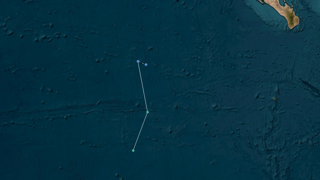
Lowell's 2026 track began in the eastern Pacific and carried the cyclone across a long stretch of open ocean before its later turn toward the north and west. The storm's eventual Category 5 peak occurred far from the East Asian mainland, and its entire tropical life remained an open-Pacific event rather than a landfalling cyclone.
The geographic setting shaped the storm's story from the beginning. Lowell developed in the eastern portion of the Pacific basin and then continued across the ocean toward the central Pacific. Instead of maintaining a westward trajectory all the way toward the Philippines, the storm changed direction at a latitude and longitude that kept its core well away from the principal island groups and coastlines of East Asia.
That track is central to understanding Lowell's 2026 history. The storm became exceptionally intense, but intensity alone did not determine where its effects were felt. A Category 5 hurricane can remain a major oceanic system while producing no direct landfall if steering currents keep its center over open water. Lowell followed that pattern.
During its mature phase, the cyclone had enough organization to support a compact, intense inner core while its larger circulation extended across a considerably wider area. Its subsequent movement demonstrated how a powerful tropical cyclone can cross an ocean basin without following the more familiar westward route toward the western Pacific.
The storm's position also placed Hawaii closer to the track than East Asia. As Lowell moved through the central Pacific, official advisories continued to monitor its proximity to the Hawaiian Islands even though the cyclone did not make landfall there. The main geographic concern was therefore the open-ocean track near Hawaii rather than a direct strike on an Asian coastline.
Lowell's later northward movement further separated the storm from a direct East Asian trajectory. Once the cyclone turned toward higher latitudes, the distance from the Philippines and other western Pacific land areas increased rather than decreased. The storm then continued westward across the central North Pacific after its tropical structure had begun to deteriorate.
This distinction between track and intensity explains why Lowell can appear on a major-hurricane retrospective without being a direct East Asian impact event. Its strongest phase was meteorologically significant, but its location kept the core over the Pacific throughout the period covered by the tropical-cyclone record.
The storm also illustrates the importance of following a cyclone's complete track rather than judging its significance from a single position. Lowell moved through several different environments during its life cycle. Its early eastern-Pacific phase led into a mature central-Pacific phase, followed by a northward turn, weakening, structural exposure, and eventual post-tropical decay.
By the time Lowell reached its final tropical position, the cyclone was far north of its earlier peak latitude. The change from a low-latitude major hurricane to a weakening system near 29°N reflected both its movement through the basin and the changing atmospheric environment surrounding the circulation.
No direct landfall occurred in China, the Philippines, Japan, or Vietnam. Those countries therefore belong to the geographic context of Lowell's track rather than to a list of confirmed landfall locations or direct coastal strike points.
For East Asia-focused tracking, that point is particularly important. Lowell's path did not bring its center into the western Pacific near the Philippines or toward the East Asian mainland. Instead, the cyclone remained within the Pacific basin and ultimately dissipated over open water.
The storm's long ocean-basin run also provided the setting for its strongest observed phase. By September 4, Lowell had become a highly organized hurricane with an exceptionally low central pressure and maximum sustained winds at the top of the Saffir-Simpson scale. The next stage of its history was therefore not a landfall but a transition through the central Pacific.
Operational Intensity Record: Lowell's Observed Peak and Structural Data
Lowell's peak operational record on September 4, 2026, consisted of 160 mph maximum sustained winds, a 922 mb minimum central pressure, and a position near 13.3°N, 161.4°W. Those measurements define the storm's maximum intensity and place its Category 5 core over open water in the central Pacific.
Observation Type Lowell Data Operational Source
Peak sustained wind 160 mph / 140 kt NHC advisory, September 4
Minimum central pressure 922 mb NHC advisory, September 4
Peak position 13.3°N, 161.4°W NHC advisory, September 4
Hurricane-force wind radius 60 miles NHC advisory, September 4
Tropical-storm-force wind radius 160 miles NHC advisory, September 4
700-mb flight-level wind 153 kt Reconnaissance observation
Saffir-Simpson category Category 5 Based on maximum sustained wind
Final tropical position 29.0°N, 169.9°W NHC advisory, September 10
Final tropical wind 50 mph NHC advisory, September 10
Final tropical pressure 997 mb NHC advisory, September 10
Dissipation forecast 0000 UTC, September 16 Final advisory forecast
The September 4 measurements capture Lowell at its strongest operationally documented point. A maximum sustained wind of 160 mph corresponds to 140 kt and places the cyclone in Category 5 on the Saffir-Simpson Hurricane Wind Scale. The accompanying 922 mb central pressure was consistent with an extremely intense tropical cyclone.
The peak position, 13.3°N, 161.4°W, is also significant. Lowell was not near the East Asian coastline when it reached its maximum intensity. The cyclone's most powerful core was located over the Pacific, well removed from China, Japan, Vietnam, and the Philippines.
The wind field extended beyond the inner core. Hurricane-force winds reached approximately 60 miles from the center, while tropical-storm-force winds extended to about 160 miles. These radii show that Lowell's circulation was substantially larger than the narrow region represented by the eye and eyewall alone.
Reconnaissance added another direct measurement to the operational picture. Aircraft observations found a 700-mb flight-level wind of 153 kt. That measurement was taken at an atmospheric level above the surface and therefore should not be treated as an identical quantity to the maximum sustained surface wind.
The two observations nevertheless describe the intensity of the same cyclone from different parts of the storm's vertical structure. The operational surface estimate reached 160 mph, while the aircraft measured 153 kt at 700 mb. Both observations were consistent with an exceptionally intense hurricane.
The 922 mb pressure also provides a separate measure of Lowell's strength. Central pressure and maximum sustained wind are related but are not interchangeable. A storm's pressure reflects the pressure deficit associated with its circulation, while the sustained-wind value describes the strength of the wind field used for the Saffir-Simpson category.
Lowell's peak therefore should be represented using all three pieces of information: 160 mph maximum sustained winds, 922 mb central pressure, and the September 4 position of 13.3°N, 161.4°W. Together, those observations give a more complete picture than any single statistic.
The operational record also establishes a useful reference point for measuring the storm's later decline. By September 10, Lowell had moved to approximately 29.0°N, 169.9°W, while its maximum sustained wind had fallen to 50 mph and its central pressure had risen to 997 mb.
That change was substantial. In six days, the cyclone moved from Category 5 intensity to a weakening tropical system near the northern central Pacific. The pressure increase of 75 mb and the 110 mph reduction in maximum sustained wind show the scale of the weakening between the documented peak and the final tropical advisory.
The numerical record also reinforces the geographic story. Lowell's strongest observation occurred at 13.3°N, while its final tropical position was near 29.0°N. The cyclone therefore traveled considerably farther north before its tropical classification ended.
This movement through latitude was accompanied by a shift in the storm's structure. The compact, organized core observed during the peak eventually became less defined as environmental conditions deteriorated. Convection weakened, the low-level circulation became increasingly exposed, and the cyclone lost the organization required to maintain its earlier intensity.
The operational record is therefore best read as a progression rather than as a single peak value: formation and strengthening, an extreme September 4 maximum, a northward turn, weakening in the central Pacific, and eventual post-tropical transition.
Peak Intensity: Lowell's Category 5 Core Under Reconnaissance
Lowell's September 4 peak was a Category 5 hurricane with 160 mph sustained winds and a 922 mb central pressure, while reconnaissance measured 153 kt at 700 mb near the storm's mature inner core. The combination of aircraft data, satellite structure, and operational analysis established the cyclone's exceptional intensity over the open Pacific.
The storm's eye and eyewall were especially well defined during the peak period. Satellite imagery showed a highly symmetric structure, a characteristic commonly associated with a mature, intense tropical cyclone. The organization of the cloud pattern provided forecasters with evidence that the circulation was supporting a very strong inner core.
Reconnaissance observations added information that satellite imagery alone could not provide. Aircraft data supplied direct measurements from within and around the circulation, including the 700-mb wind of 153 kt. The mission therefore contributed an independent observational layer to the operational intensity estimate.
The 160 mph surface wind estimate remained the defining value for the Saffir-Simpson classification. At that speed, Lowell was firmly within Category 5 territory. The storm's 922 mb central pressure further documented the depth of the circulation at the time of maximum intensity.
Lowell's hurricane-force wind radius was about 60 miles. This indicates that the strongest winds occupied a relatively concentrated portion of the overall circulation. Beyond that inner region, the tropical-storm-force wind field extended to roughly 160 miles.
The difference between those two radii is useful when describing the storm's footprint. The hurricane-force wind field represented the area capable of producing the most severe wind conditions, while the broader tropical-storm-force field covered a much larger surrounding region.
The storm's intensity was therefore not simply a single point of extreme wind. Lowell had an organized circulation, a pronounced eye and eyewall, a broad tropical-storm wind field, and a pressure center measured at 922 mb.
Its location during this period limited the direct terrestrial consequences of that intensity. At 13.3°N, 161.4°W, the cyclone was positioned over the Pacific rather than over or immediately adjacent to a densely populated East Asian coastline. The strongest winds remained an oceanic hazard.
This is also why the storm's Category 5 designation should not be confused with an East Asian landfall classification. Lowell was a Category 5 hurricane geographically located in the Pacific. It was not a typhoon making landfall in China, Japan, Vietnam, or the Philippines.
The terminology follows the basin and warning structure in use for the storm. Lowell was handled as a hurricane within the eastern and central Pacific operational framework. It did not enter a western Pacific landfall scenario requiring a change to the regional naming system used for storms affecting areas farther west.
The September 4 peak also represented only one stage in the cyclone's life. A major hurricane can weaken rapidly once its environmental support changes. Lowell's later history shows that the same circulation that produced a 922 mb pressure center could lose its tropical structure within days.
After the peak, the storm's movement carried it farther north and eventually toward the central North Pacific. The increasingly unfavorable environment affected both convection and the organization of the low-level circulation. The hurricane's structure became less symmetrical as the storm weakened.
The progression from an organized Category 5 hurricane to an exposed tropical storm was visible in subsequent operational analyses. Convection no longer remained concentrated around the center, and the low-level circulation became increasingly displaced from the deepest remaining thunderstorms.
That structural change helps explain the rapid decline in the operational intensity record. The peak wind of 160 mph was associated with a well-organized inner core. The later 50 mph tropical-storm estimate came after that core had deteriorated.
The reconnaissance record thus anchors the most intense phase of Lowell's history. Satellite observations showed the storm's organization, aircraft data supplied a 153 kt flight-level measurement, and the operational analysis assigned 160 mph maximum sustained winds with a 922 mb minimum pressure.
Together, these observations establish a clear September 4 maximum without requiring the peak to be connected to any land impact. Lowell's most intense period was an open-Pacific meteorological event.
The Northward Turn: Why Lowell Never Reached East Asia
Lowell's northward turn kept the cyclone away from a direct East Asian landfall, and its track instead carried the circulation into the central Pacific before the storm weakened. By the end of its tropical phase, the center was near 29.0°N, 169.9°W, far from China, the Philippines, Japan, and Vietnam.
The track matters because the Pacific is large enough for a powerful cyclone to remain hundreds or thousands of miles from land throughout its life. Lowell's peak intensity did not place it on a trajectory toward the East Asian mainland. Its later movement northward changed the storm's geographic relationship with the western Pacific.
At its peak, Lowell was near 13.3°N, 161.4°W. Its final tropical position was near 29.0°N, 169.9°W. The shift from the lower to the higher latitude shows how the cyclone moved away from its earlier tropical environment and toward the central North Pacific.
The northward component of the track was especially important for the storm's eventual outcome. A continued low-latitude westward track could have carried Lowell closer to the western Pacific island groups. Instead, the cyclone moved north, increasing its separation from the Philippines and the East Asian mainland.
Japan also remained outside the cyclone's direct track. Although the storm ultimately reached a much higher latitude than at its peak, it did so while remaining over the open Pacific. The center did not reach the Japanese coastline.
The same applies to China and Vietnam. Neither country experienced a verified Lowell landfall. The storm's final tropical circulation remained over the central Pacific, where it weakened before the system could approach the Asian mainland.
The Philippines likewise remained outside the storm's direct path. Lowell's development and mature phases occurred far to the east, and the subsequent northward turn prevented the cyclone from becoming a Philippine landfalling system.
For Hawaii, the geographic relationship was different. The islands were much closer to Lowell's central-Pacific track and therefore appeared in official monitoring and advisory discussions. Even so, the cyclone did not make a direct Hawaiian landfall.
The open-water setting affected the nature of the hazard. A hurricane with 160 mph winds is capable of extreme damage if its core crosses land, but Lowell's peak wind field remained over the ocean. Its strongest documented winds therefore did not translate into a Category 5 landfall in East Asia.
The storm's movement also demonstrates why a storm's longitude alone does not determine its likely destination. Lowell's peak longitude of 161.4°W placed it well into the Pacific, and its later position near 169.9°W remained in the central North Pacific. The cyclone never crossed into an East Asian coastal impact corridor.
Its northward turn was therefore more than a directional change on a map. It altered the storm's entire subsequent life cycle. As Lowell gained latitude, it moved away from the warm, tropical setting associated with its strongest phase and toward an environment less favorable for maintaining a deep tropical circulation.
The resulting sequence was straightforward: the storm peaked at low latitude, turned north, moved across the central Pacific, weakened, and ultimately lost its tropical characteristics. The path did not end at a continental coastline.
The absence of an East Asian landfall should also be separated from the possibility of indirect regional effects. A large Pacific cyclone can influence marine conditions or produce distant swell without its center making landfall. Such effects are different from a direct hurricane or typhoon strike.
For Lowell, the verified geographic record supports a much narrower conclusion. The cyclone remained over the Pacific, approached no listed East Asian landfall location, and ended its tropical life northwest of Hawaii.
The track also explains why references to China, Japan, Vietnam, or the Philippines belong in the article primarily as exclusions. None of those countries was the site of a confirmed Lowell landfall. The storm's defining geographic feature was its open-ocean trajectory.
By September 10, the center was near 29.0°N, 169.9°W. That position marked the end of Lowell's tropical advisory period and placed the weakening system in the central North Pacific, well removed from the Asian mainland.
The final track consequently reinforces the same geographic pattern established at the peak: exceptional intensity without a corresponding East Asian coastal strike. Lowell's 2026 record is a Pacific storm track story as much as it is an intensity story.
Rapid Decay: From Major Hurricane to Exposed Tropical Storm
Lowell fell from 160 mph Category 5 intensity on September 4 to 50 mph by its final tropical advisory on September 10, while its central pressure rose from 922 mb to 997 mb as convection weakened and the low-level center became increasingly exposed. The six-day decline marked a rapid transition from a tightly organized major hurricane to a broad, weakening tropical cyclone in the central Pacific.
The structural deterioration became increasingly apparent as Lowell moved northward. The storm no longer maintained the same concentrated deep convection around the center that characterized its Category 5 phase. Instead, the low-level circulation became displaced from the remaining thunderstorms.
Vertical wind shear contributed to that change. Stronger winds at different atmospheric levels can tilt a tropical cyclone's circulation and separate the low-level center from the deepest convection. As Lowell encountered increasing shear, the storm's inner structure lost the symmetry visible during its peak.
Dryer mid-level air also became part of the weakening environment. A tropical cyclone depends on sustained deep convection to maintain the release of heat that supports its warm-core circulation. When convection becomes fragmented or displaced, the storm's ability to preserve its previous intensity declines.
Marginal sea-surface temperatures added another limitation. Lowell had moved away from the low-latitude environment in which it reached Category 5 strength. As the cyclone progressed northward, the surrounding ocean and atmosphere became less supportive of a strong tropical core.
The operational intensity numbers show the result clearly. The minimum pressure increased by 75 mb between the September 4 peak and the final tropical position. Maximum sustained winds dropped by 110 mph over the same period.
The storm did not simply become smaller while retaining the same structure. Its organization changed. The well-defined inner core seen during the peak gave way to a circulation in which the strongest convection was increasingly separated from the center.
By September 10, Lowell was being analyzed as a broad tropical storm before its formal post-tropical classification. Its position near 29.0°N, 169.9°W placed it substantially farther north than the September 4 peak at 13.3°N, 161.4°W.
The weakening phase was also reflected in the wind estimates used operationally. Later advisories incorporated available satellite and scatterometer observations while recognizing that the storm's structure was becoming increasingly difficult to characterize as a compact tropical cyclone.
The low-level circulation became exposed as deep convection diminished. Once the center is no longer embedded beneath persistent thunderstorms, the system has difficulty sustaining the organization associated with a mature tropical cyclone.
This was the opposite structural state from the September 4 peak. Lowell's Category 5 phase featured a well-defined eye, a symmetric eyewall, and extreme wind measurements. Six days later, the center was exposed and the remaining convection was insufficient to preserve the storm's earlier tropical structure.
The change in pressure is another indication of the weakening process. A 922 mb center represented the storm's deepest documented pressure, while 997 mb at the final tropical position showed a much less intense circulation. The pressure rise accompanied the loss of the cyclone's deep convective organization.
Lowell's final tropical wind estimate of 50 mph placed it well below hurricane strength. The system had therefore crossed several operational thresholds during its decline, moving from Category 5 to major-hurricane weakening and then to tropical-storm intensity.
The transition to post-tropical status followed the loss of persistent deep convection near the center. The storm was no longer maintaining the structure required for continued classification as a tropical cyclone.
The official final advisory sequence placed the post-tropical transition on September 10. The forecast at that stage extended the system's remaining circulation into the following days, with dissipation projected for 0000 UTC September 16.
The forecast dissipation date did not represent another period of tropical intensification. It marked the expected end of the remaining circulation after the system had already lost its tropical characteristics.
This final phase is important because the storm's life cycle did not end immediately when it ceased to be a hurricane. Tropical cyclones can weaken into tropical storms, then become post-tropical systems, while residual circulation and wind fields persist for some time afterward.
Lowell followed that sequence over the central Pacific. Its tropical classification ended near 29.0°N, 169.9°W, but the broader circulation remained part of the forecast track after the final tropical advisory.
The storm's rapid decay also reinforces the importance of using the correct date when describing its intensity. Lowell was a Category 5 hurricane on September 4, not a Category 5 system throughout its final week. By September 10, its operational wind estimate was 50 mph and its pressure was 997 mb.
The six-day comparison therefore provides the clearest measure of the weakening:
September 4: 160 mph, 922 mb, Category 5, 13.3°N, 161.4°W.
September 10: 50 mph, 997 mb, final tropical position near 29.0°N, 169.9°W.
September 16: 0000 UTC dissipation point in the forecast record.
That sequence captures the storm's transition from an exceptionally intense tropical cyclone to a decaying open-ocean system without attaching the weakening to an East Asian landfall that never occurred.
Final Track Record: Lowell's Open-Pacific End State
Lowell's tropical record ended near 29.0°N, 169.9°W with 50 mph winds and a 997 mb central pressure, and the remaining system was forecast to dissipate by 0000 UTC September 16. The final position left Lowell in the central North Pacific, confirming that its 2026 life cycle ended over open water rather than in China, the Philippines, Japan, or Vietnam.
The final advisory marked the end of Lowell's official tropical-cyclone sequence. At that point, the cyclone no longer had the persistent deep convection and organized tropical structure required for continued tropical classification.
Its final tropical position was significantly north of its September 4 maximum. Lowell had moved from 13.3°N at peak intensity to approximately 29.0°N by the end of the tropical record. The storm therefore completed its life cycle while moving into the higher-latitude central Pacific.
The final wind speed of 50 mph was less than one-third of the September 4 peak wind speed. The pressure had also risen substantially, from 922 mb to 997 mb. These two measurements document the scale of the storm's decay.
The final wind field was still broad enough to matter operationally even though the cyclone had lost its earlier intensity. The weakening circulation remained an open-ocean weather system rather than a landfalling hurricane.
Hawaii remained the nearest major land area of interest during the central-Pacific portion of Lowell's track. The final tropical position was northwest of the Hawaiian Islands, but the cyclone did not make a direct landfall there.
The storm's relationship with East Asia remained unchanged through the end of the record. No verified Lowell landfall occurred in China, the Philippines, Japan, or Vietnam. The final track remained over the Pacific.
That geographic fact also determines how Lowell should be described in a regional retrospective. The storm was a major hurricane of the eastern and central Pacific, not an East Asian landfall event. Its importance to an East Asia-focused review lies in the track that kept it away from those countries.
The final phase also demonstrates why post-tropical classification should not be treated as an immediate disappearance. When a tropical cyclone becomes post-tropical, the broader circulation can persist after the system no longer meets the structural definition of a tropical cyclone.
For Lowell, the official forecast extended the remaining circulation beyond September 10, with dissipation projected at 0000 UTC September 16. The forecast endpoint therefore belongs to the storm's post-tropical decay phase rather than to its period of tropical intensity.
The complete track can be reduced to several defining stages:
Eastern Pacific development: Lowell formed and strengthened while moving across the Pacific basin.
Category 5 peak: On September 4, the cyclone reached 160 mph with a 922 mb central pressure near 13.3°N, 161.4°W.
Northward turn: The track shifted toward higher latitude, keeping the cyclone away from a direct East Asian landfall.
Central-Pacific weakening: The storm encountered conditions associated with deteriorating convection and an increasingly exposed low-level center.
Final tropical position: On September 10, Lowell was near 29.0°N, 169.9°W with 50 mph winds and a 997 mb pressure.
Post-tropical decay: The remaining circulation was forecast to dissipate by 0000 UTC September 16.
The September 4 peak remains the numerical center of the storm's intensity record. The September 10 advisory provides the corresponding endpoint for its tropical phase. Between those dates, Lowell changed both in intensity and structure while continuing across the open Pacific.
The storm's maximum intensity and final location also tell two different stories. The 160 mph wind and 922 mb pressure describe how strong Lowell became. The 29.0°N, 169.9°W final position describes where that system ended its tropical life. Neither measurement alone captures the full event.
The combination is what makes the track notable. Lowell reached the highest category on the Saffir-Simpson scale, yet the cyclone never brought its core ashore in the East Asian countries often associated with westward-moving Pacific tropical cyclones.
Frequently Asked Questions
Did Lowell make landfall in China?
No verified Lowell landfall occurred in China. The cyclone remained over the Pacific throughout its tropical life and became post-tropical in the central North Pacific.
Did Lowell affect the Philippines directly?
Lowell did not make a direct landfall in the Philippines. Its track remained east of the Philippine archipelago and later turned northward rather than continuing on a westward path toward the islands.
Did Lowell reach Japan?
No. Lowell's tropical track remained over the Pacific and ended near 29.0°N, 169.9°W. The cyclone did not make landfall in Japan.
Did Lowell make landfall in Vietnam?
No. Vietnam was not a Lowell landfall location. The cyclone remained in the Pacific and never reached the Vietnamese coast.
Where was Lowell at peak intensity?
Lowell reached its documented peak on September 4, 2026, near 13.3°N, 161.4°W. Maximum sustained winds were 160 mph, and the minimum central pressure was 922 mb.
Was Lowell a Category 5 hurricane?
Yes. Its maximum sustained wind of 160 mph placed Lowell in Category 5 on the Saffir-Simpson Hurricane Wind Scale.
What was Lowell's lowest pressure?
The minimum central pressure was 922 mb on September 4, 2026, during the storm's Category 5 peak.
How large was Lowell at peak intensity?
At peak intensity, hurricane-force winds extended approximately 60 miles from the center, while tropical-storm-force winds extended about 160 miles.
What did reconnaissance find inside Lowell?
Aircraft reconnaissance measured a 153 kt wind at the 700-mb flight level during the storm's intense phase. The observation supplemented the operational surface-wind estimate and other satellite-based assessments.
Where was Lowell when it became post-tropical?
Lowell became post-tropical near 29.0°N, 169.9°W on September 10, 2026. At its final tropical position, maximum sustained winds were 50 mph and central pressure was 997 mb.
When was Lowell forecast to dissipate?
The final advisory forecast dissipation by 0000 UTC September 16. That forecast referred to the remaining post-tropical circulation after the official tropical phase had ended.
Was Lowell a typhoon?
No. Lowell was handled as a hurricane in the eastern and central Pacific operational framework. It did not become a western North Pacific typhoon or make the transition into an East Asian landfall scenario.
Why is Lowell relevant to an East Asia-focused storm review if it never reached East Asia?
Its relevance is geographic rather than landfall-related. Lowell reached Category 5 intensity in the Pacific, then turned north and weakened while remaining over open water. The resulting track is a clear example of a very intense Pacific cyclone that did not reach China, the Philippines, Japan, or Vietnam.
Conclusion
Lowell's 2026 record combines an extreme Category 5 peak with an entirely open-Pacific tropical life cycle. On September 4, the cyclone reached 160 mph and 922 mb near 13.3°N, 161.4°W, with reconnaissance measuring 153 kt at 700 mb and the strongest winds concentrated within a 60-mile hurricane-force radius.
The storm then turned north and continued across the central Pacific rather than reaching East Asia. Its circulation weakened as convection deteriorated and the low-level center became increasingly exposed, bringing the maximum sustained wind down to 50 mph and the central pressure up to 997 mb by September 10.
Lowell's final tropical position near 29.0°N, 169.9°W placed the system northwest of Hawaii and well away from China, the Philippines, Japan, and Vietnam. The remaining circulation was forecast to dissipate by 0000 UTC September 16.
No verified Lowell landfall occurred in China, the Philippines, Japan, or Vietnam. The cyclone's final official tropical-cyclone position remained in the central North Pacific, closing a 2026 storm history defined by exceptional intensity, a northward Pacific detour, rapid structural decay, and post-tropical dissipation over open water.