
Live Typhoon Path Tracker
StormAtlas provides real-time path tracking and historical archives for Western Pacific and South China Sea typhoons. Access live position updates, forecast tracks, central pressure, wind speeds, and historical typhoon trajectories.
🌐Showing your local time
Current Active Storms
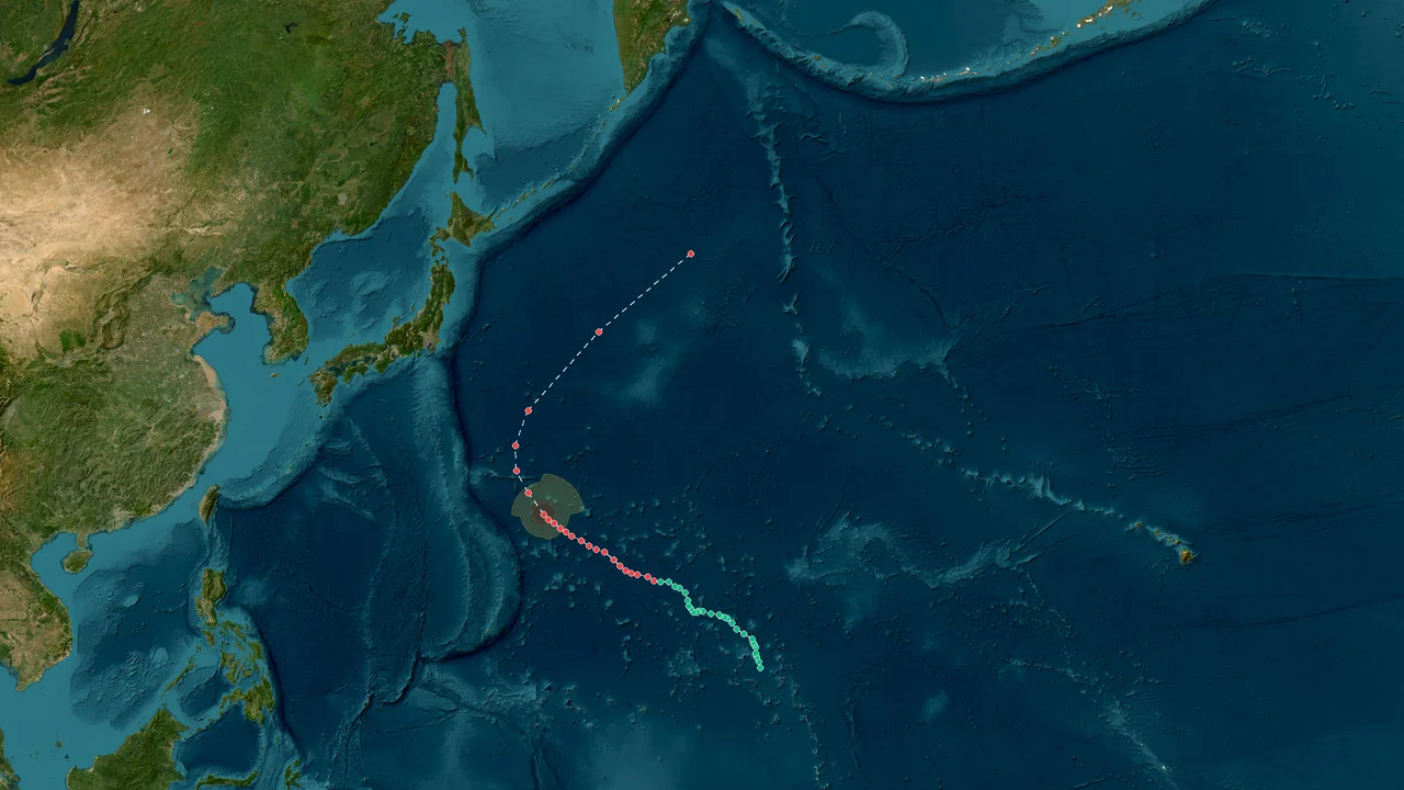
Typhoon Koguma (2026)
Formation Time: 05 Oct 2026 11:00 GMT+11
Formation Location: West Pacific(10.4°N, 168.1°E)
Max Wind Speed: 162 km/h
Min Pressure: 950 hPa
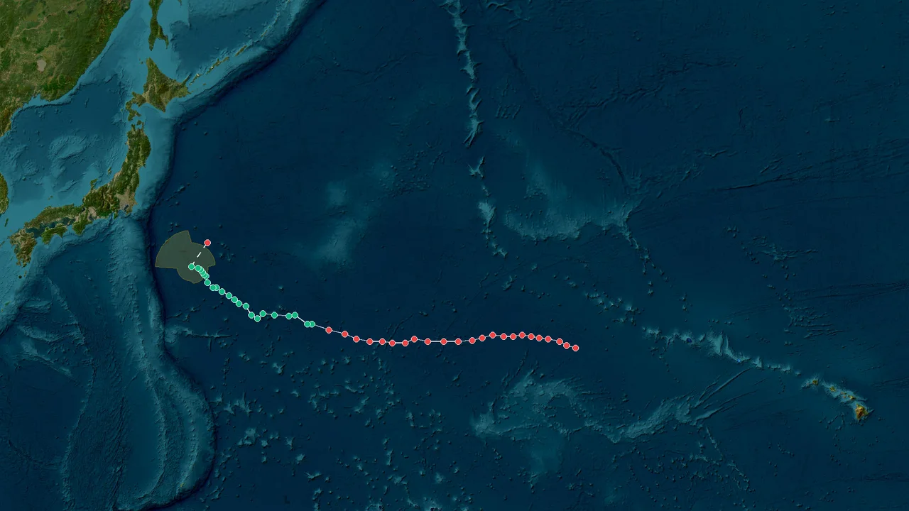
Tropical Storm Nolo (2026)
Formation Time: 05 Oct 2026 12:00 GMT+12
Formation Location: West Pacific(24.8°N, 179.4°E)
Max Wind Speed: 180 km/h
Min Pressure: 950 hPa
Historical Storm Database
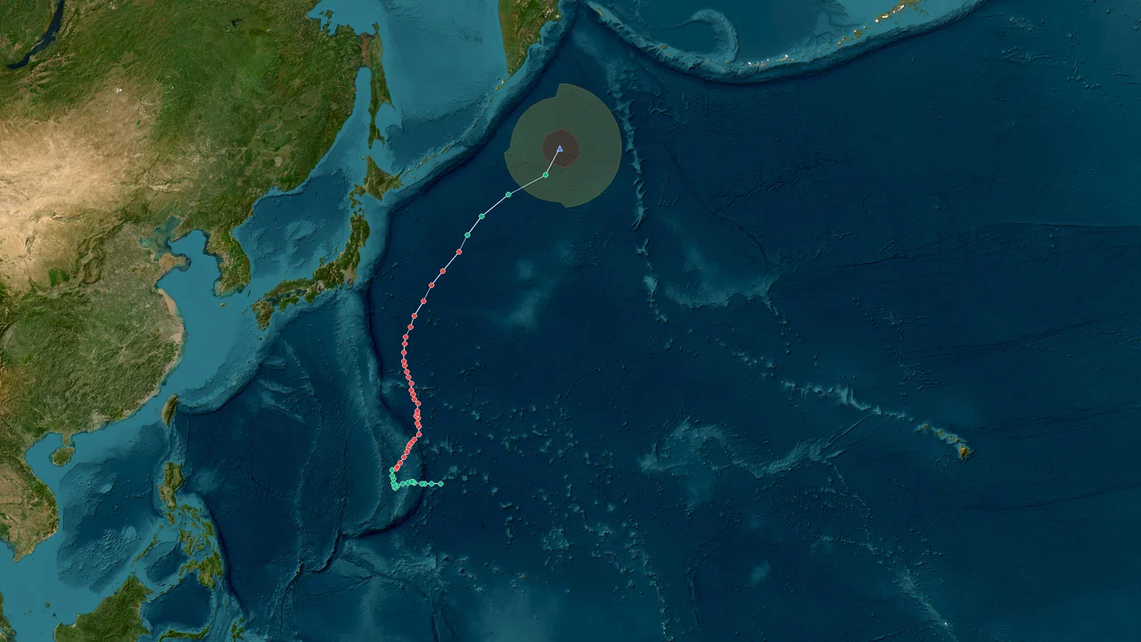
Extratropical Low Choi-wan (2026)
Formation Time: 01 Oct 2026 04:00 GMT+10
Formation Location: West Pacific(16.4°N, 149.5°E)
Dissipation Time: 07 Oct 2026 22:00 GMT+10
Max Wind Speed: 180 km/h
Min Pressure: 925 hPa
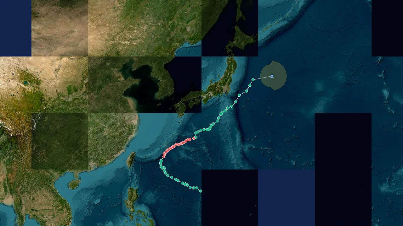
Extratropical Low Surigae (2026)
Formation Time: 24 Sep 2026 06:00 GMT+9
Formation Location: West Pacific(17.9°N, 134.8°E)
Dissipation Time: 02 Oct 2026 03:00 GMT+9
Max Wind Speed: 180 km/h
Min Pressure: 945 hPa
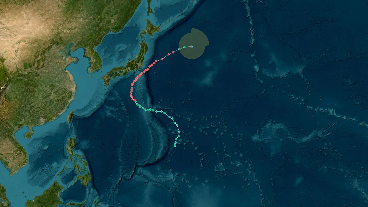
Extratropical Low Dujuan (2026)
Formation Time: 16 Sep 2026 22:00 GMT+10
Formation Location: West Pacific(16.4°N, 149.4°E)
Dissipation Time: 22 Sep 2026 22:00 GMT+10
Max Wind Speed: 144 km/h
Min Pressure: 960 hPa

Extratropical Low Bang-lang (2026)
Formation Time: 28 Aug 2026 14:00 GMT+11
Formation Location: West Pacific(18.4°N, 165.1°E)
Dissipation Time: 31 Aug 2026 11:00 GMT+11
Max Wind Speed: 126 km/h
Min Pressure: 980 hPa

Tropical Depression Saudel (2026)
Formation Time: 19 Aug 2026 13:00 GMT+10
Formation Location: West Pacific(8.3°N, 153.7°E)
Dissipation Time: 03 Sep 2026 22:00 GMT+10
Max Wind Speed: 176 km/h
Min Pressure: 935 hPa
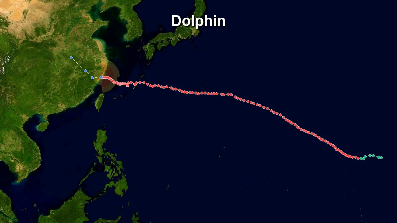
Tropical Depression Dolphin (2026)
Formation Time: 27 Jul 2026 18:00 GMT+12
Formation Location: West Pacific(13.2°N, 176.9°E)
Dissipation Time: 11 Aug 2026 18:00 GMT+12
Max Wind Speed: 234 km/h
Min Pressure: 910 hPa

Tropical Depression Noul (2026)
Formation Time: 23 Jul 2026 06:00 GMT+9
Formation Location: West Pacific(15.8°N, 130.4°E)
Dissipation Time: -
Max Wind Speed: 144 km/h
Min Pressure: 960 hPa

Extratropical Low Bavi (2026)
Formation Time: 02 Jul 2026 11:00 GMT+11
Formation Location: West Pacific(10.3°N, 159.9°E)
Dissipation Time: 15 Jul 2026 11:00 GMT+11
Max Wind Speed: 223 km/h
Min Pressure: 915 hPa
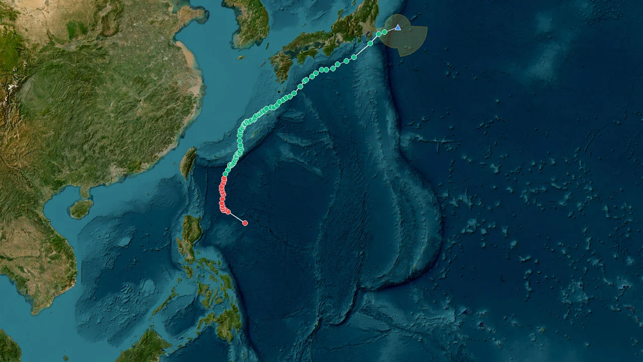
Extratropical Low Mekkhala (2026)
Formation Time: 22 Jun 2026 14:00 GMT+8
Formation Location: West Pacific(17.8°N, 127.0°E)
Dissipation Time: 27 Jun 2026 20:00 GMT+8
Max Wind Speed: 180 km/h
Min Pressure: 935 hPa

Tropical Storm Jangmi (2026)
Formation Time: 27 May 2026 15:00 GMT+9
Formation Location: West Pacific(9.6°N, 137.5°E)
Dissipation Time: 04 Jun 2026 03:00 GMT+9
Max Wind Speed: 137 km/h
Min Pressure: 973 hPa

Typhoon Sinlaku (2026)
Formation Time: 12 Apr 2026 13:00 GMT+10
Formation Location: West Pacific(10.1°N, 150.9°E)
Dissipation Time: -
Max Wind Speed: 252 km/h
Min Pressure: 900 hPa

Tropical Depression 天琴 (2025)
Formation Time: 25 Nov 2025 20:00 GMT+8
Formation Location: West Pacific(11.0°N, 120.2°E)
Dissipation Time: -
Max Wind Speed: 119 km/h
Min Pressure: 975 hPa

Tropical Depression Koto (2025)
Formation Time: 23 Nov 2025 21:00 GMT+9
Formation Location: West Pacific(7.4°N, 131.6°E)
Dissipation Time: 03 Dec 2025 21:00 GMT+9
Max Wind Speed: 137 km/h
Min Pressure: 976 hPa

Tropical Depression Fung-wong (2025)
Formation Time: 06 Nov 2025 03:00 GMT+9
Formation Location: West Pacific(9.6°N, 142.1°E)
Dissipation Time: 13 Nov 2025 09:00 GMT+9
Max Wind Speed: 162 km/h
Min Pressure: 950 hPa

Tropical Depression Kalmaegi (2025)
Formation Time: 31 Oct 2025 21:00 GMT+9
Formation Location: West Pacific(8.0°N, 140.4°E)
Dissipation Time: 08 Nov 2025 03:00 GMT+9
Max Wind Speed: 205 km/h
Min Pressure: 950 hPa

Extratropical Cyclone Nakri (2025)
Formation Time: 06 Oct 2025 22:00 GMT+10
Formation Location: West Pacific(13.2°N, 147.4°E)
Dissipation Time: 16 Oct 2025 16:00 GMT+10
Max Wind Speed: 130 km/h
Min Pressure: 970 hPa

Extratropical Cyclone Halong (2025)
Formation Time: 03 Oct 2025 10:00 GMT+10
Formation Location: West Pacific(20.1°N, 147.4°E)
Dissipation Time: 11 Oct 2025 22:00 GMT+10
Max Wind Speed: 220 km/h
Min Pressure: 936 hPa

Tropical Depression Matmo (2025)
Formation Time: 01 Oct 2025 03:00 GMT+9
Formation Location: West Pacific(13.7°N, 132.9°E)
Dissipation Time: 06 Oct 2025 21:00 GMT+9
Max Wind Speed: 162 km/h
Min Pressure: 967 hPa

Tropical Depression Bualoi (2025)
Formation Time: 23 Sep 2025 03:00 GMT+9
Formation Location: West Pacific(11.3°N, 137.3°E)
Dissipation Time: 30 Sep 2025 21:00 GMT+9
Max Wind Speed: 137 km/h
Min Pressure: 974 hPa

Extratropical Cyclone Neoguri (2025)
Formation Time: 17 Sep 2025 23:00 GMT+11
Formation Location: West Pacific(22.6°N, 166.1°E)
Dissipation Time: 01 Oct 2025 11:00 GMT+11
Max Wind Speed: 227 km/h
Min Pressure: 936 hPa
Storm Database Information
StormAtlas maintains one of the most comprehensive tropical cyclone databases available online. Our records cover storms across all major ocean basins including the Western Pacific, Eastern Pacific, Atlantic, Indian Ocean and South Pacific. Data is sourced from official meteorological agencies including JMA, NHC, JTWC and CMA.
Frequently Asked Questions about Storm Atlas
How to track Western Pacific typhoons in real-time?
StormAtlas integrates public data from JTWC, JMA, and CMA, providing live typhoon coordinates, wind speed, central pressure, and official forecast tracks.
How often are typhoon tracking data and satellite imagery updated?
Active typhoon data and high-resolution satellite imagery are automatically refreshed in real time with the latest meteorological bulletins.
Where do typhoons primarily form?
Typhoons form primarily in the Northwestern Pacific Ocean, affecting countries and regions including the Philippines, Taiwan, China, Japan, and Vietnam.
Typhoon Dynamics, Monsoons & Regional Standards
Typhoons develop over the warm waters of the Northwest Pacific Basin (between 180° and 100°E). This basin produces nearly one-third of the world’s annual tropical cyclones, monitored by RSMC Tokyo (JMA), the China Meteorological Administration (CMA), and PAGASA (Philippines).
Unlike Atlantic hurricanes, typhoons can form year-round, peaking from July through October. The massive heat content of the Western Pacific Warm Pool frequently triggers Rapid Intensification (RI) into Super Typhoons.
Different nations utilize distinct wind measurement averaging times, causing apparent numerical variance.
Frequently Asked Meteorological Questions
Aligned with official WMO and regional meteorological agency guidance